Oceanfront concession Puerto Nuevo Dominical

Corporate sale · Costa Rica · South Pacific coast

Oceanfront concessionPuerto Nuevo, Dominical— Costanera Sur, South Pacific, Costa Rica

Opportunity to acquire a Costa Rican holding company with a beachfront concession ready for development, backed by advanced municipal and environmental filings.

Corporation
Desarrollos Puertocito Tres S.A.
Tax ID
3-101-197643
Project areas
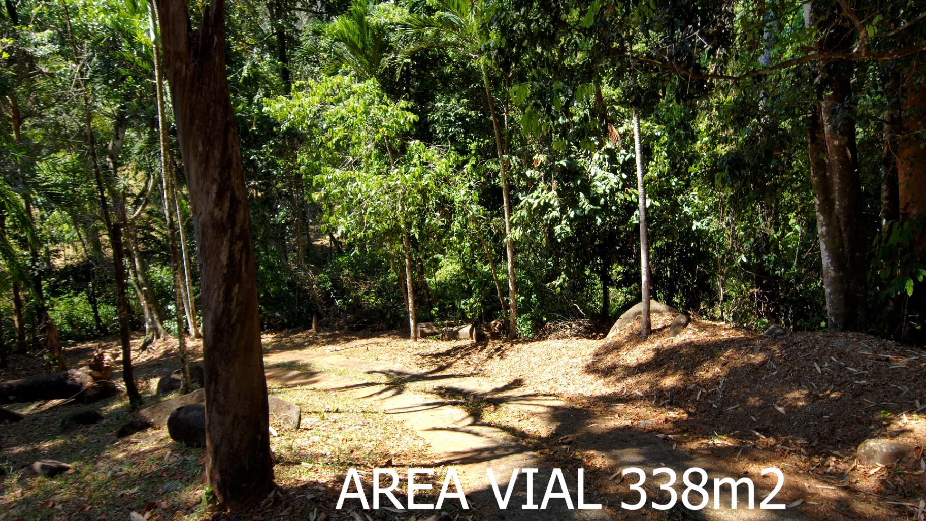
831 m² — concession 2,702.36 m² — PNE 222.08 m² — reclassification 338 m² — road 4,093.44 m² — total
Location
Puerto Nuevo, Dominical, Costanera Sur

The property

831 m² between IGN markers M94 and M95, facing the Pacific.

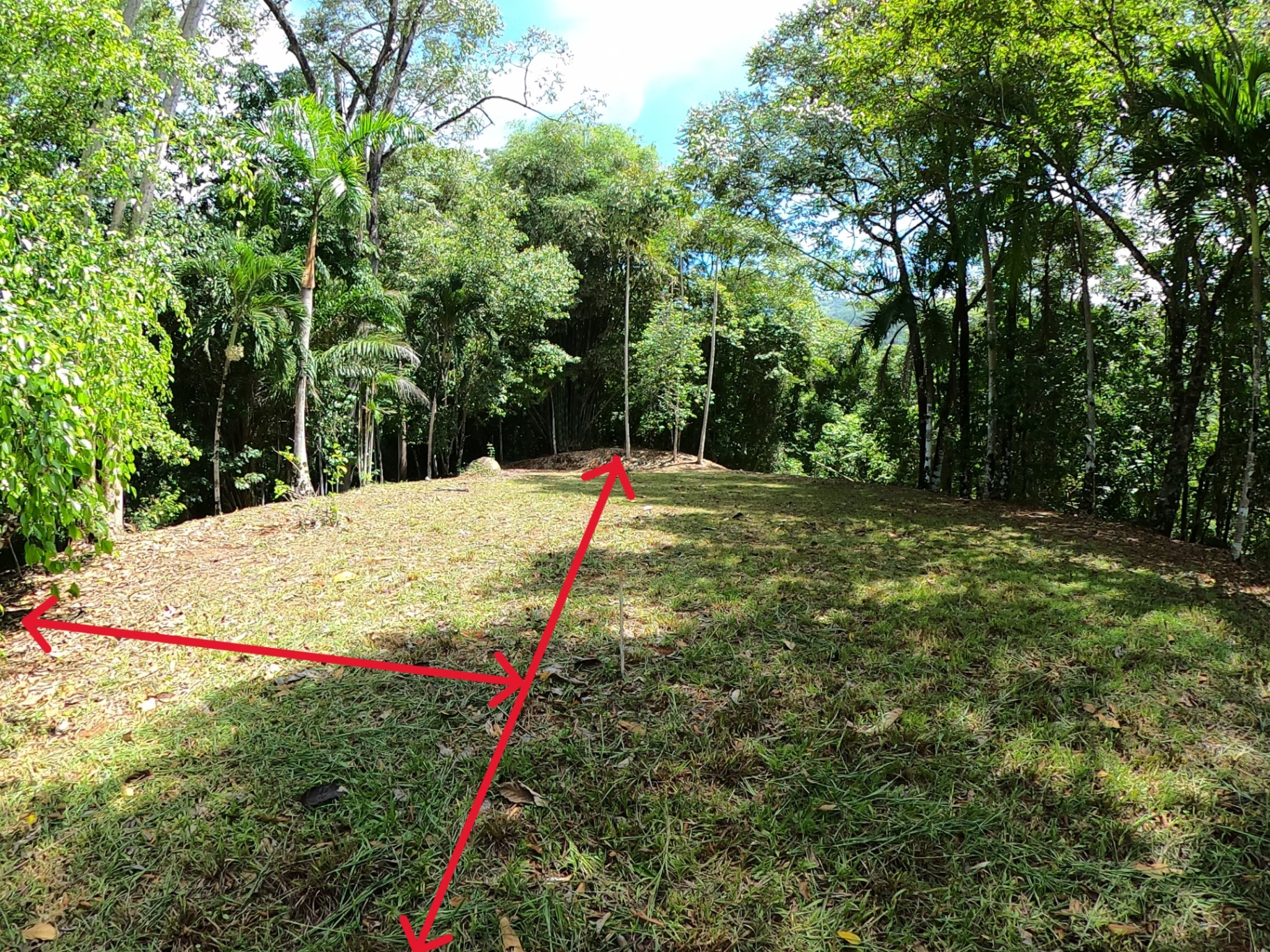
Flat parcel with direct access to a 14-meter public road and an existing footpath to the beach. Cadastrally registered (survey 6-15722-2024) inside the Puerto Nuevo coastal sector, adjoining State Natural Heritage land and a short distance from Ballena Marine National Park and Dominical Beach.

Registered survey
6-15722-2024
Real folio
6-001326Z-000
Public road frontage
9.55 m (14 m ROW)
Boundary markers
M93 – M96 (IGN)
CRTM05 coordinates
521721.5 E · 1017861.4 N
District / County
Bahía Ballena · Osa · Puntarenas

Residential project

Beach house with absolute privacy, immersed in nature.

The property includes a viable preliminary project to develop for a two-level residence designed by Architect Enrique Barascout. The project takes advantage of a unique setting surrounded by primary forest, with private beach access and open views of the Pacific Ocean and the coastal mountains. It is a beach house ready to build, with terraces, a swimming pool, a double garage, and spaces integrated with the natural surroundings.

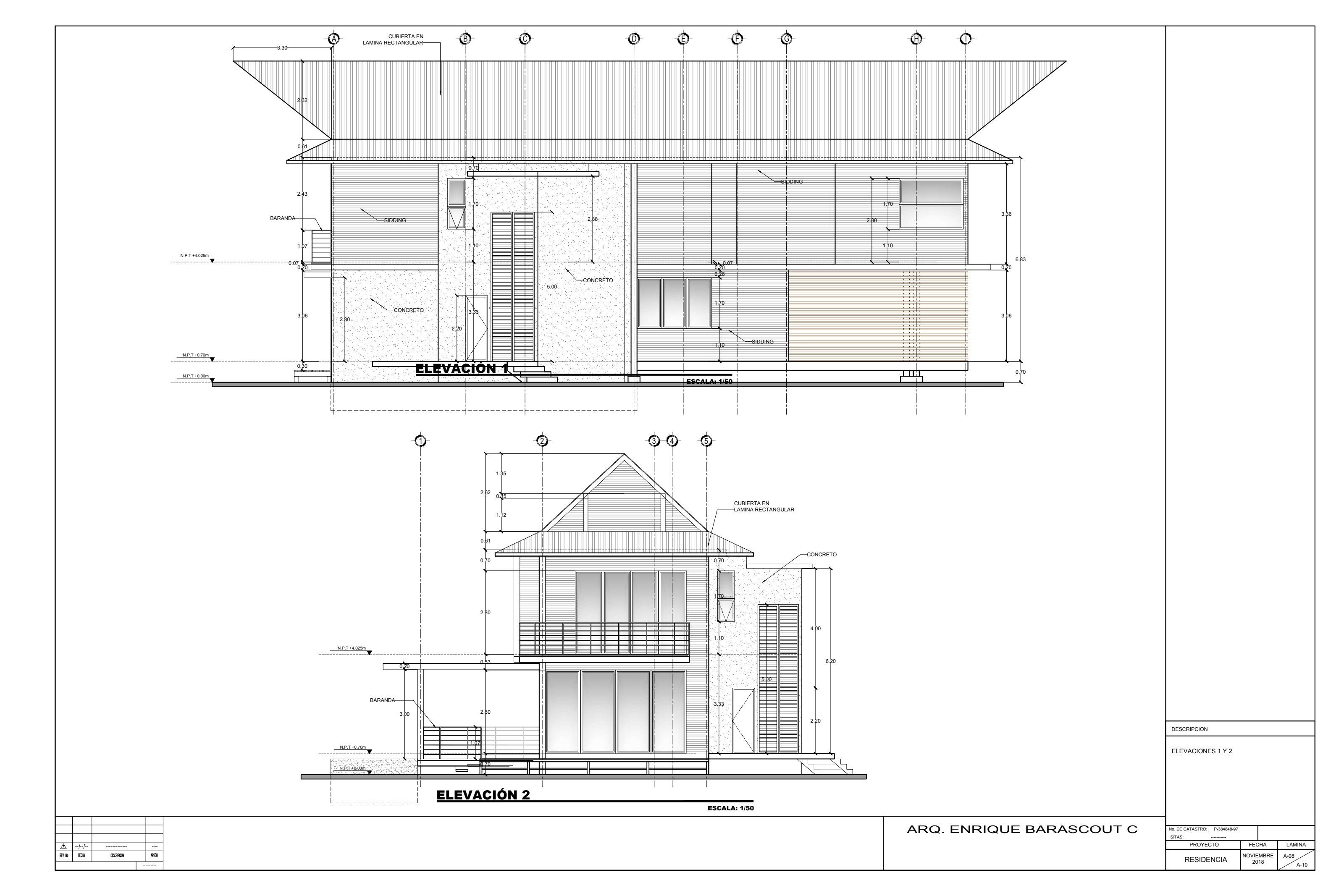
Residence elevations — facades facing the Pacific and the forest.
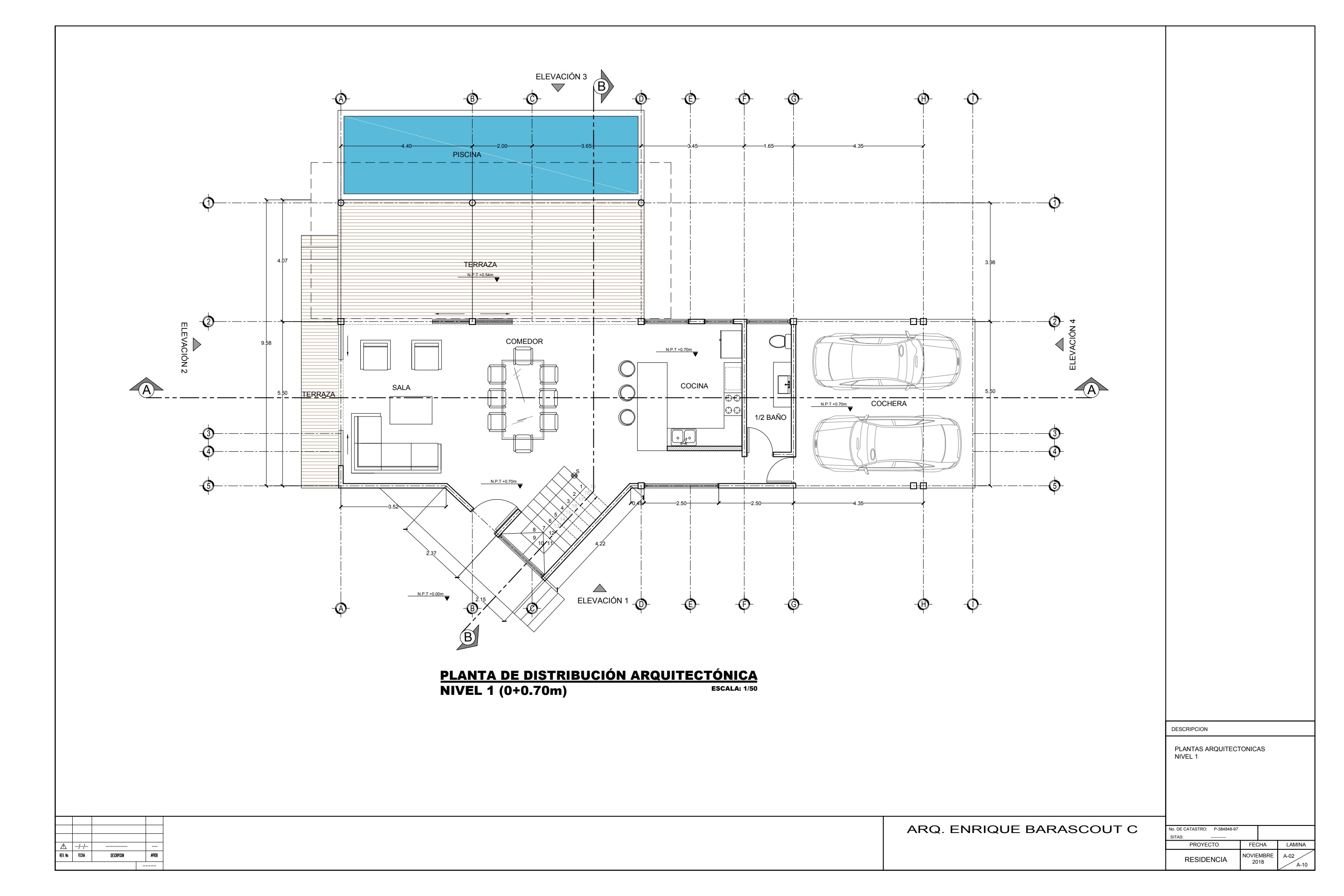
Level 1 architectural plan — living room, dining room, kitchen, terrace, and pool.
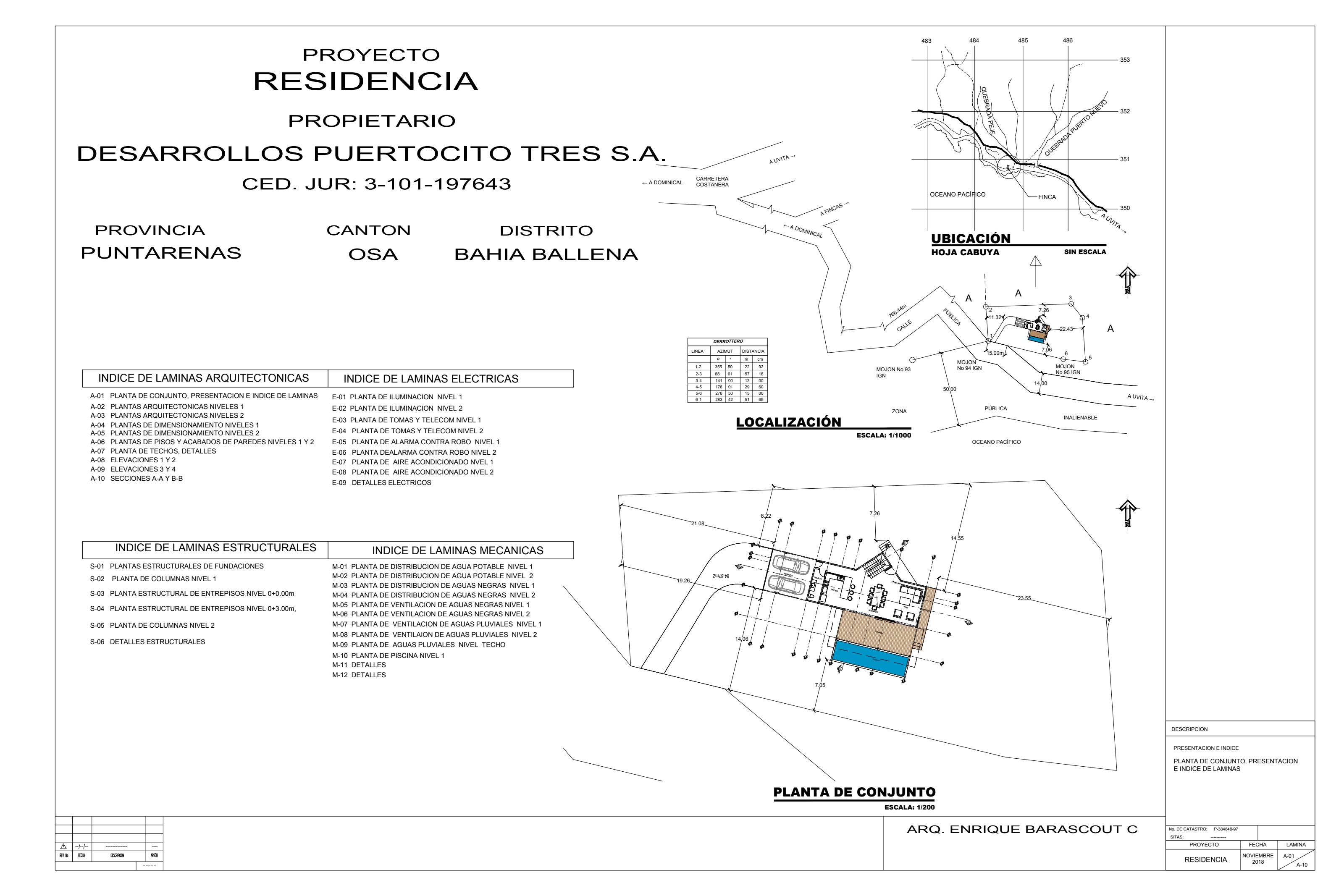
Site plan — location of the house within the concession parcel.
  • 01Absolute privacy: independent parcel surrounded by primary forest and away from immediate neighbors.
  • 02Private beach access and a natural trail connecting to the Pacific coast.
  • 03Panoramic ocean and mountain views from terraces and main living spaces.
  • 04Approved architectural plans (2018): 2-level residence, pool, garage, and terraces.
  • 05Immersed natural setting, ideal for a relaxed beach house connected to nature.
Arch. Enrique Barascout C.Catastro No. P-384848-97November 2018

Land location

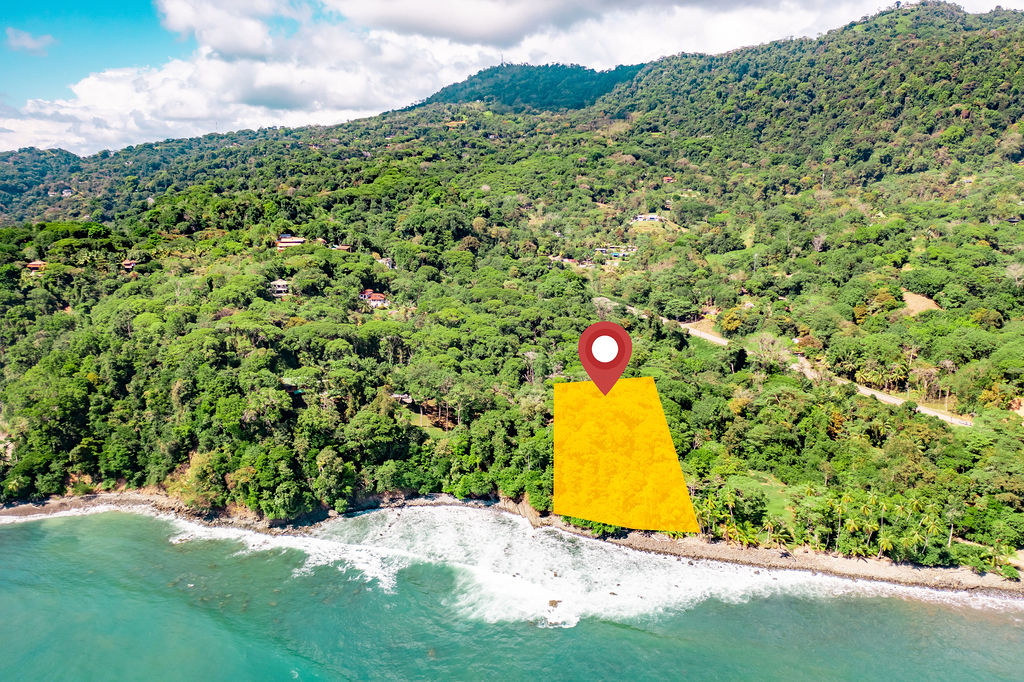
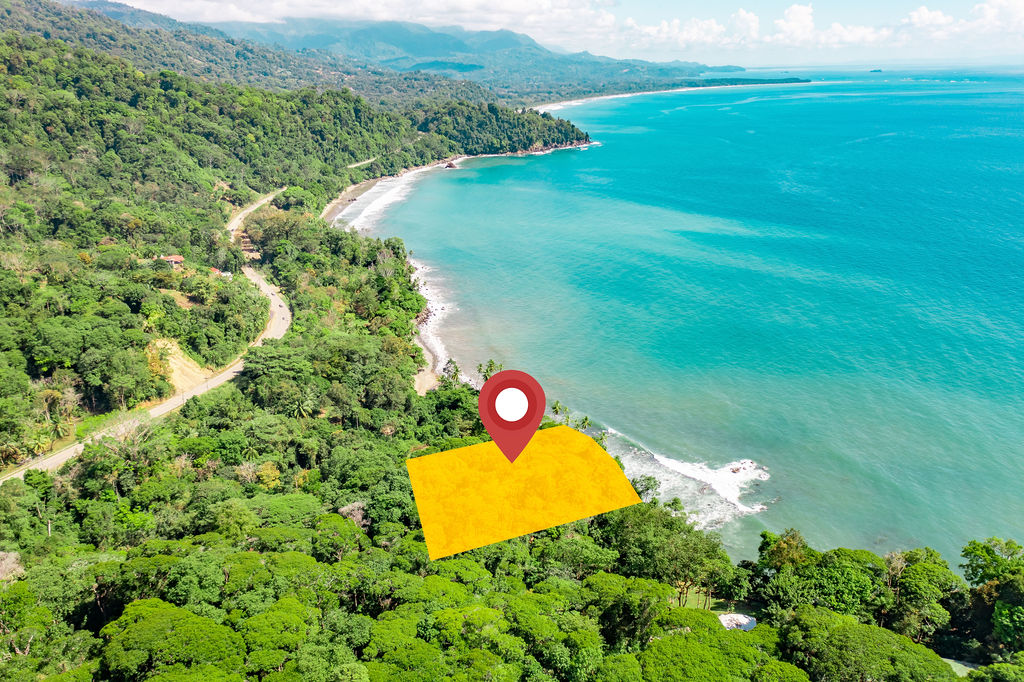
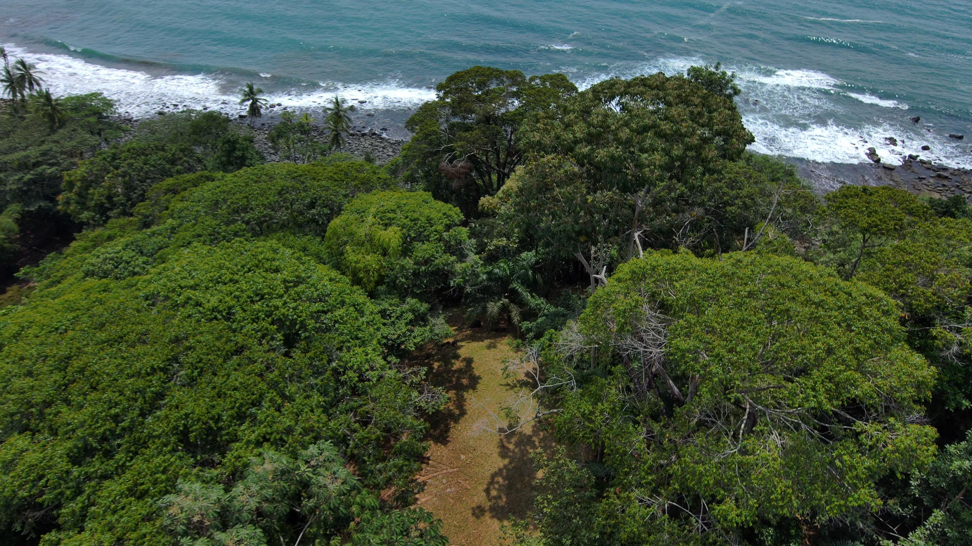
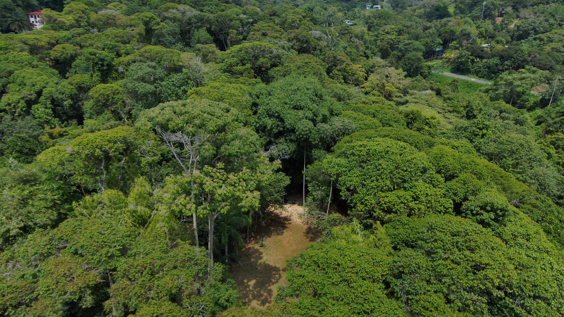
Aerial location of the parcel

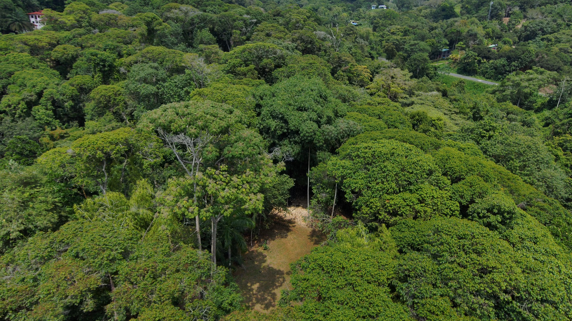
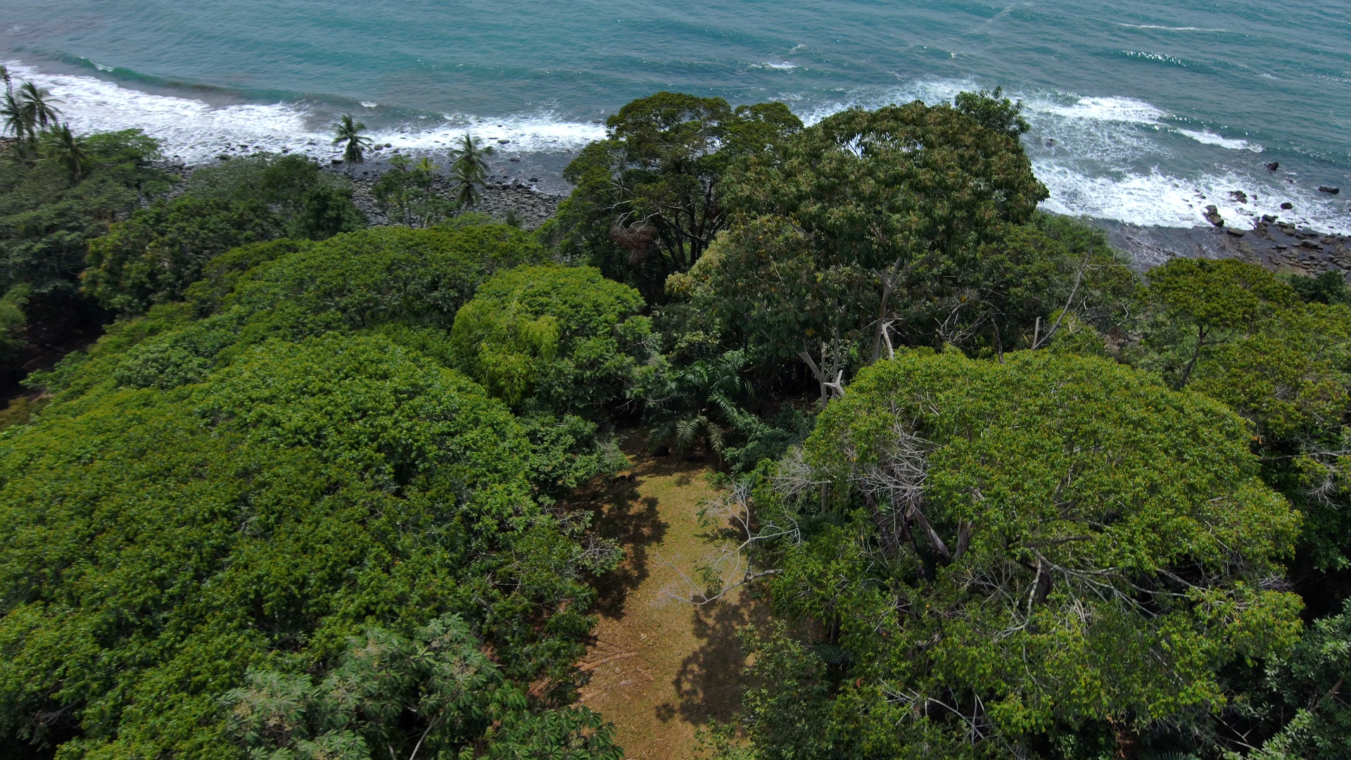
Aerial views showing the exact position of the land facing the Pacific, between markers M94 and M95 in Puerto Nuevo.

Side view from the south — parcel highlighted along the coast.
01 · Side view from the south — parcel highlighted along the coast.
Panoramic view to the north — Bahía Ballena in the background.
02 · Panoramic view to the north — Bahía Ballena in the background.
Top-down view — parcel polygon and coastal edge.
03 · Top-down view — parcel polygon and coastal edge.

Status summary

How the key filings are progressing

Four files are advancing in parallel and adding value to the corporation. The concession renewal already has a favorable municipal inspection; the State Natural Heritage land-use filing was expanded in 2025; the 222.08 m² reclassification now has a professional forestry study confirming Non-Forest coverage; and the 338 m² road area completes the operative polygon.

  • 2022

    Concession renewal filed

    Favorable ruling

    Municipality of Osa opens file 614-2022 to renew the Maritime Zone concession held by Desarrollos Puertocito Tres S.A.

  • 2023

    Favorable municipal inspection

    Favorable ruling

    Ruling AIZ-0051-2023 confirms 831 m² within municipal administration and outside State Natural Heritage affectation.

  • 2022

    Land-use filing on PNE submitted

    In progress

    ACOSA–MINAE file ACOSA-PU-SRD-014-2022 is submitted for trails, conservation and protection over adjoining State Natural Heritage land.

  • 2025

    Land-use expansion filed

    In progress

    An amendment adds 2,702.36 m² to protect the creek and coastal forest near the beach.

  • 2026

    PNE area reclassification

    In progress

    File 96-2026 includes a professional forestry study confirming Non-Forest coverage on 222.08 m² previously flagged as PNE.

  • 2026

    Road area incorporated

    In progress

    The 338 m² road area is added to the project's operative polygon, completing access connectivity.

  • 2026

    Final rulings

    Pending

    Municipality of Osa and MINAE rulings are awaited to consolidate project viability.

Active filings

Four live files that add value and pave the runway.

Active filings — Maritime Zone Concession renewal
01 · Municipality of Osa
831

Maritime Zone Concession renewal

File 614-2022

Renewal of the concession held by the corporation, with favorable municipal inspection (Ruling AIZ-0051-2023) and a rectified 831 m² area confirmed inside municipal administration, outside PNE affectation.

Active filings — Land-use permit on State Natural Heritage
02 · ACOSA – MINAE
2,702.36

Land-use permit on State Natural Heritage

File ACOSA-PU-SRD-014-2022

Land-use application for trails, conservation and protection over the adjoining PNE. A 2025 amendment adds 2,702.36 m² covering a creek and coastal forest, expanding the stewardship footprint.

Active filings — PNE area reclassification
03 · Municipality of Osa
222.08

PNE area reclassification

File 96-2026

Reclassification of 222.08 m² previously flagged as PNE, backed by a professional forestry study confirming Non-Forest coverage — the basis for reincorporating the area into the concessionable polygon.

Active filings — Project road access
04 · Road Area
338

Project road access

Road area 338 m²

338 m² road area that integrates project access and connectivity with the public road, completing the operative polygon alongside the municipal and environmental filings.

Municipality + MINAE + Reclassification + Road — Total project area
Total project area
4,093.44
Municipality + MINAE + Reclassification + Road

Consolidated sum across the four filings that define the project's operative footprint.

Regulatory plan

Low-Density Residential Zone (ZRbd).

Declared tourism-apt sector (Gazette N°163, 08/27/2013). Permitted use: single-family residence. Conditional uses: sport, ranchos, pools.

Max. coverage
40%
Setbacks
3 m side, front and rear
Max. height
2 stories · 10 m
Lot size
300 – 2,000 m²
Max. slope
< 30%

The opportunity

Corporate sale with residential project in the Maritime-Terrestrial Zone, South Pacific of Costa Rica

The transaction is structured as a 100% share transfer of Desarrollos Puertocito Tres S.A., preserving the concession, all municipal and environmental files, and continuity before MINAE. Built for investors seeking a consolidated position on Costa Rica's South Pacific coast, in a declared tourism sector with growing demand.

  • 01Active 831 m² oceanfront concession, plus 2,702.36 m² State Natural Heritage land-use permit, 222.08 m² PNE reclassification, and 338 m² road area — 4,093.44 m² total of advanced filings that reduce risk and time to market.
  • 02100% share transfer: acquire the corporation and inherit all rights, permits and live proceedings.
  • 03Strategic location in Dominical, Costa Ballena, with strong tourism demand and sustained appreciation.
  • 04Backed by registered survey, forestry study, corporate standing and powers of attorney; ready for serious negotiation.
Contact

Full dossier and site visit available on request.

Write us to receive the digital file including surveys, official rulings, corporate standing and the forestry study.

Ana Montesino Rodríguez · Legal Representative

Send us your inquiry

WhatsApp Request dossier